Tracker, messenger or AIS? Which works best
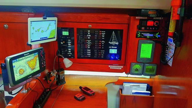
As organisers of long-distance voyages, our experience with satellite phones has not been especially good — they are expensive, they offer no position tracking, and we use them only in genuinely difficult situations. That is the main reason we decided to try the cheap and widely available satellite messengers and trackers. And because we recently ran into exceptionally hard conditions, these devices — along with the onboard AIS — went through a demanding test that taught us a great deal about their strengths and weaknesses.
A prolonged spell of severe weather in January of this year kept us trapped for days in the marina at Mohammedia, one of the ports on the North African coast of the Atlantic.
At the end of January we decided to leave the safety of the harbour and make a risky passage south along the dangerous edge of a depression. That was when our devices proved indispensable, each of them useful in its own way — although only precise data from shore and satellite allowed us to avoid trouble. Here is a detailed comparison and an assessment of how useful each one is.
Garmin inReach Explorer +
Once the subscription is paid, the Garmin works globally on the 70-satellite Iridium network, including the far north and far south, allowing you to send and receive an unlimited number of text messages to any domestic or foreign number. Transmission delay is around two to five minutes. The waterproof unit can hold maps of the entire world, gives satellite position, course and speed on its built-in display and on an online map accessible to anyone who knows your login. The Garmin stores this data and shares it over Bluetooth with one paired smartphone.
It can also be operated from that smartphone, which means the inReach can sit somewhere else entirely on the yacht. It does, however, need a clear view of at least one fifteenth of the sky. The inReach also allows you to call for help immediately through the GEOS system (the International Emergency Response Coordination Center) anywhere in the world, and because it works both ways you know almost at once whether the call was received. Rescue services then stay in continuous contact with you until the danger has passed. It can also be used ashore, where it additionally gives altitude above sea level; we tested its resistance to low temperature in January on the highest peak in North Africa.
Photo: manufacturer materials
With support from people ashore, the Garmin lets us receive marine forecasts and lightning positions, and communicate fully with ports. Its battery, charged over micro-USB, lasts only a dozen or so hours, but a power bank helps — on our boat it recharged the unit in a few dozen minutes.
The device costs around 2,190 PLN, and the highest monthly subscription — with tracking, unlimited messages and insurance — runs to 250–300 PLN. An annual subscription is considerably cheaper. The lowest activation, with online tracking and a limit of a few dozen messages, is only around 60 PLN a month. Details are available from the Polish distributor. For comparison, a text message on a satellite phone costs 0.8 to 2 PLN, a minute of call time 3 to 8 PLN, and the handset itself 2,500 to 4,500 PLN.
In a single month on the ocean we exchanged over 300 text messages through the Garmin, which at average satellite-phone rates would have cost us around 550 PLN. This device performed best during both the passage and the expedition into remote mountains; we rate it highest of the three, particularly in relation to price.
SPOT Gen 3
The unit has been available in Poland for several years but never gained much of a following. Operating on the 40-satellite Globalstar network, it allows you to call for help via SOS or through the GEOS system. It also allows a non-life-threatening assistance request — signalling that you need help rather than rescue — and the sending of satellite notifications. The SPOT Gen 3 has wide coverage, though not in polar regions, and offers continuous online tracking of its position on Google maps. To use that function aboard the yacht, however, you need internet access.
Photo: manufacturer materials
It is the cheapest tracker that also works as a satellite messenger, letting you send messages to, say, the people waiting for you in port to let them know about delays. Anyone who has ever waited several days without news of when their family will finally reach harbour knows how much that matters. All messages go to a defined group of recipients — ten phone numbers or ten e-mail addresses — with the number of such notifications capped at a few hundred a year.
The device weighs half as much as the Garmin and can be powered by four AAA batteries or over micro-USB. It handles GPS coverage very well: one twenty-fifth of the sky in view is enough for correct operation, and the yacht’s laminate has virtually no effect on satellite reception.
The SPOT Gen 3 works one way only, however, so you receive no confirmation — for instance whether the beacon’s signal is being picked up. From reports and our own experience we also know that, for safety, it should be restarted every twelve hours. For the user it is a passive device, right up until a situation arises that requires help or a notification.
For people ashore, and for anyone monitoring safety, this tracker-messenger is invaluable and performs very well. We have used it successfully for years on expeditions and passages, giving everyone concerned confidence about the safety of crew and boat. I recommend it to anyone looking for a versatile and reasonably priced device — it costs around 980 PLN, with annual activation at roughly 100–150 dollars.
Class B AIS
The purpose of the Automatic Identification System is the mutual identification of nearby vessels, giving name, tonnage, course, speed and other navigational data, and warning of collision risk. AIS works only between vessels fitted with the system, which at present is compulsory only on convention ships (subject to SOLAS) over 300 gross tonnes, on fishing vessels over 15 m, and on all passenger ships. Yachts and small fishing boats are not required to carry it — and unfortunately often do not.
Photo: manufacturer materials
AIS works as a tracker on online maps only within range of VHF transceivers and shore-based transponders, so out on the ocean a yacht with this system is invisible. In open waters there is a separate, commercial S-AIS, fitted only to convention ships. AIS can transmit distress messages only over DSC radio links (digital selective calling). Moreover, devices of this type have until now been assigned to a specific vessel; only recently has it become possible to assign them to a user. Off the north-west coast of Africa, fewer than one in ten of the fishing vessels we encountered carried AIS, so we could not count on it to keep us clear of a collision. AIS only reduces that danger.
For me the most important thing about AIS is the ability to identify an MMSI number and call a ship automatically over VHF. Outside Europe ships often ignore calls from small craft, but thanks to AIS we can find that ship’s MMSI number and oblige it to answer our call over DSC. Such calls are recorded as a matter of obligation and must be responded to.
An AIS unit — receiver and transmitter — costs between 3,000 and as much as 12,000 PLN, but there is no subscription and no annual registration fee. If you hold an assigned MMSI radio station number, which costs a few hundred PLN as a one-off at the Office of Electronic Communications, there are no further running costs either. There is also a cheaper, passive AIS that is receive-only, about which other ships get no information.
Conclusion
All the devices assessed here are extremely useful in day-to-day use, easy to obtain, and significantly improve the safety of boat and crew. I rate the Garmin inReach Explorer + highest: it is useful at sea and ashore, and worth taking along on both passages and journeys. The cheapest is the SPOT Gen 3, also very useful as a versatile tracker and simple messenger. Class B AIS is a system that supports safety, but given its limited range it should be backed up by global systems.